Dear Dhamma friends,
Today I needed to show to my little students how the Queen Mahā Māyā traveled from Kapilavatthu to Devadaha. On a map.
But… Instead of showing this to them, I had to apologize that I have no such map. ![]() One of the confusing point was, that some maps show Lumbini North from Kapilavatthu, and some others show Lumbini South from Kapilavatthu.
One of the confusing point was, that some maps show Lumbini North from Kapilavatthu, and some others show Lumbini South from Kapilavatthu. ![]()
I remember that several years ago I saw a very reliable, detailed map in the book “Geography Of Early Buddhism” by Bimala Churn Law and F.W. Thomas, 2008. Somehow either the map is not scanned in my private resources or simply it was in a different book. So, I scoured my enormous database of Buddhist sources and realized, that we need a map of Buddhist India.
At the same time, I found also many interesting resources that could help.
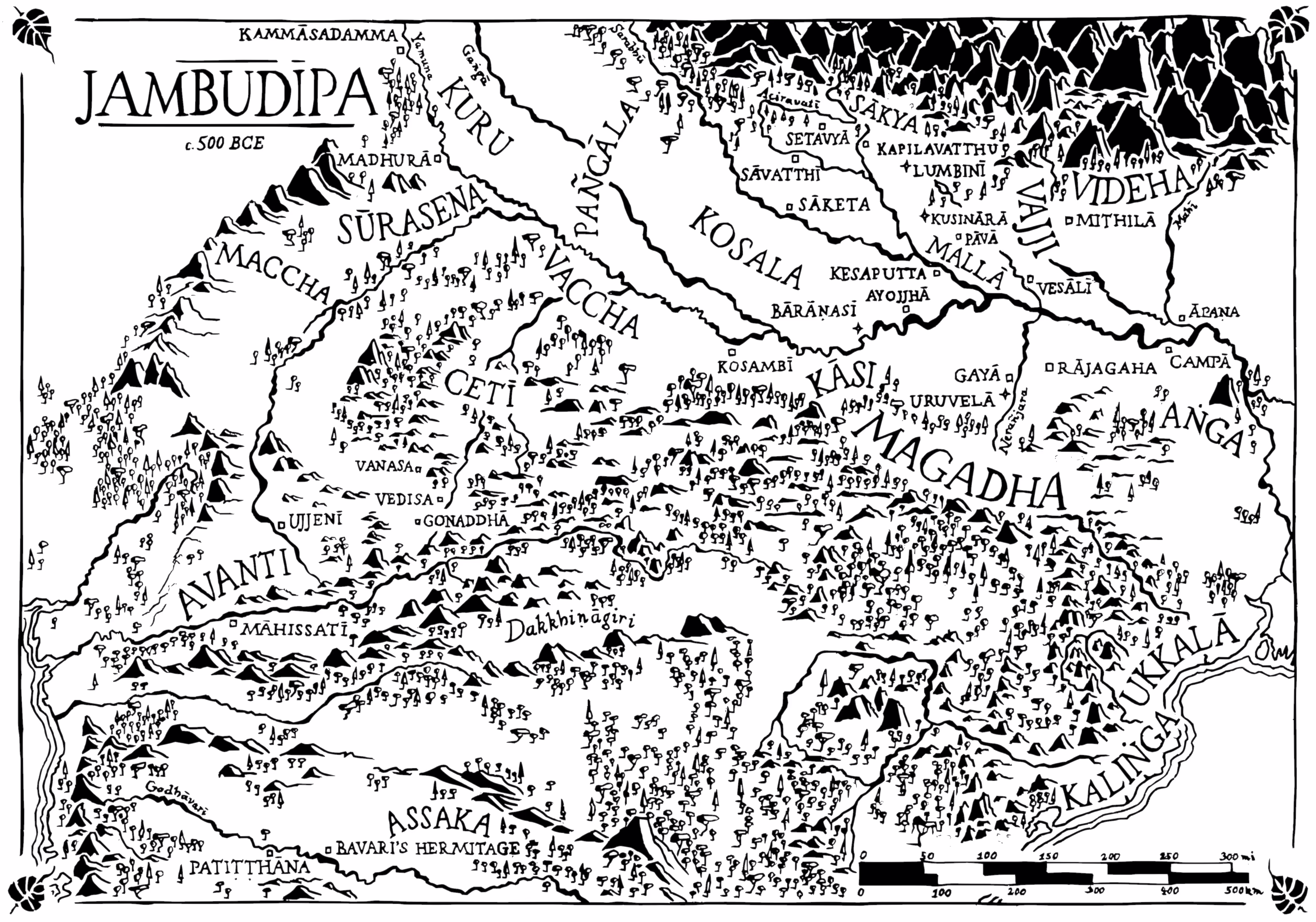
(1) Probably the most interesting resource is the magnificent work done by Venerable Sujato: announcement ; the map alone ; discussion
→ But Devadaha is not there. Also, I worry that it does not consider the Commentarial explanations. Also, we do not learn what are the sources for this map, so it’s hard to estimate its accuracy.
(2) A collection of detailed maps created and prepared by venerable Anandajoti (PDF)
(3) An interesting map of the King Milinda’s India
(4) A comparison of three maps, based on the conquest of King Kosala, Ajatasattu, Vidudabha, and Udayana
Then there are several literary resources available for download.
What would it take to set up a team of professional cartographers (ideally Indian or scholars of India), who would be most enthusiastic to make an interactive map such as the one of venerable Sujato, which will reflect the teachings in Theravāda Tipiṭaka and Commentaries, and which will also help understand the subtle changes in the ancient Indian geography during the Buddha’s time (and possibly short time after the Parinibbāna)?
Any suggestion will be most appreciated. ![]()